Integrated Into Landscapes, Seascapes and Ocean
What do we mean by integration?
As biodiversity continues to decline, focusing on protected areas and other effective area-based conservation measures OECMs as solutions alone has proven insufficient. The broader drivers of biodiversity loss need to be addressed. For example, restoring degraded areas between protected areas and OEMCs, reducing pollution impacts, or preventing the “leakage” of deforestation displaced by protected areas and OECMs into the surrounding landscape.
Integrating protected areas and OECMs into wider landscapes, seascapes and the ocean implies that these areas should not be considered or managed as isolated islands for biodiversity, but rather as part of wider strategies for conservation and sustainable development beyond the areas themselves. This includes integration in terms of geography and biology (i.e., connectivity, buffers, etc.), policy coherence and coordination, and social integration. elsewhere on this site, so the focus here is on restoration and integration into policy and social systems.
Linking restoration and integration into policy and social systems
Integration involves factoring protected areas and OECMs into broader sectoral and development planning, including local, national and regional spatial planning and water basin planning. It means considering the impacts and dependencies between protected areas and OECMs and surrounding areas and people. This will likely involve sustainable management, halting of Land-Use-Change (LUC) damaging to biodiversity, restoration of areas outside protected areas and OECMs and management of shared lands, inland waters and oceans, particularly in areas of importance for biodiversity or ecosystem services. It will involve legislation enabling and requiring more strategic siting of infrastructure and more wildlife-friendly designs for that infrastructure, such as dams and roads, to ensure overall natural system connectivity necessary to conserve biodiversity within PCAs.
An overview of the state of partially degraded areas can help prioritize areas for restoration; enhancing ecological representation and connectivity, while providing refuges for biodiversity, with these areas potentially integrated into the network of PCAs over time. The Global Human Footprint Index maps out states of degradation. Restoration and conservation activities have the potential to halt biodiversity loss, but only if the broader drivers of biodiversity loss are also addressed such as the overconsumption of natural resources and the pollution of areas important for biodiversity and ecosystem services.
Planners will likely need to identify the many ways in which PCAs and the surrounding nature are enhancing human well-being, such as the provision of ecosystem services and economic benefits. Such an exercise can be done using tools like the Protected Areas Benefits Assessment Tool. This knowledge will be important for informing sustainable management and restoration of areas outside the area covered by Target 3.
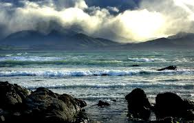
Policy makers in shipping and fisheries should safeguard Blue Corridors, Arctic superhighways for migrating whales, seals and walrus, by reducing ship speeds, rerouting vessels, regulating sonar usage and mitigating risks of oil spills. These international waters would then be better integrated into the PCAs of the Arctic region.
Enabling factors and challenges
Integration of PCAs into wider landscapes and seascapes will bring many Global Biodiversity Framework (GBF) targets and other international agreements into alignment. GBF Targets 1–3 are tightly connected to this component, and Target 4 on species and reduction of human-wildlife conflict, Target 7 on reducing the impacts of pollution and Targets 9 and 10 on sustainable use and management.
Like connectivity, this component needs to involve stakeholders outside typical conservation actors. Blue Corridors for example would need to involve the ministries of fisheries, shipping and maritime affairs. This presents both a challenge – securing the buy-in of stakeholders with very diverse interests, often unfamiliar with biodiversity conservation – and an opportunity to generate support for conservation from a much broader segment of society.
Technical guidelines for biosphere reserves
https://unesdoc.unesco.org/ark:/48223/pf0000375692_eng
The purpose of the Technical Guidance for Biosphere Reserves (TGBR) is to support the implementation of the articles of the Statutory Framework and subsequent Strategies and Action Plans. It is based on the practical experience of the Man and Biosphere (MAB) Programme. As the TGBR cannot respond to all possible questions and needs, its design is purposefully flexible and will be periodically updated. It is also designed to be used in conjunction with the TGBR support webpage, where topics can be shared and discussed in greater detail.
The primary target group of this document is stakeholders of existing and prospective biosphere reserves. The term ‘stakeholder’ is used in this document for reasons of simplicity, as the individuals and groups concerned with, and with a stake in, biosphere reserves are as diverse as the biosphere reserves themselves. They include all right holders at all levels of society and may have various levels of affiliation to the MAB Programme.
Integrated Biodiversity Assessment Tool (IBAT) is a subscription-based service providing open and free access to global biodiversity maps and paid services such as reports, packaged data downloads, and web services.
UNESCO Biosphere Reserves are sites for testing interdisciplinary approaches to understanding and managing changes and interactions between social and ecological systems, including conflict prevention and management of biodiversity.

The IUCN-WCPA paper “An overview of […] Spatial Planning and Target 1 under the Convention on Biological Diversity [K-M GBF]” reviews and synthesizes Participatory, Integrated, and Biodiversity-Inclusive Spatial Planning.

UNU-IAS’s Using Landscape Approaches in National Biodiversity Strategy and Action Planning explores the transformative potential of landscape approaches in biodiversity conservation.
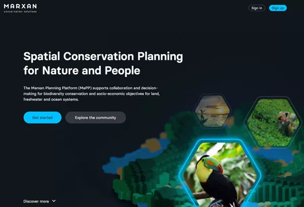
The Marxan Planning Platform (MaPP) is a free online tool designed to aid practitioners in spatial planning for effective and equitable conservation interventions and development of strategies for area-based conservation.